News Summary
A Severe Thunderstorm Watch has been issued for most of North Texas, including Dallas and Tarrant Counties, until morning on Memorial Day. Residents should prepare for rain and possible storms beginning overnight, with forecasts predicting up to three inches of rain and increased flooding risks. Meteorologists also warn of continued storms throughout the day, particularly if an approaching weather front stalls. Following the holiday weekend, cooler temperatures and more storms are expected later in the week.
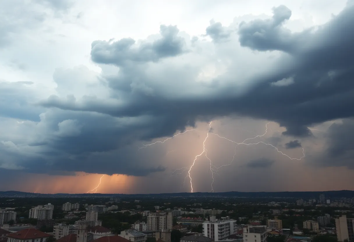
Dallas, Texas – A Severe Thunderstorm Watch has been issued for nearly all of North Texas, including Dallas and Tarrant Counties, until 5 a.m. on Memorial Day. Residents should prepare for a chance of rain and storms moving through the region, beginning around 3 a.m., and continuing through the early morning hours.
The severe weather threat is anticipated to persist during the first part of Memorial Day, with the possibility of increased flooding as the day progresses. Meteorologists are forecasting rain accumulations of up to three inches in a short period, raising concerns about localized flooding.
As thunderstorms develop overnight, the highest likelihood for rainfall is expected to be in the morning hours. Storms may continue to impact the area depending on the behavior of an approaching weather front. If the front stalls near the I-20 corridor, additional thunderstorms could occur, further complicating the weather situation.
Following the holiday weekend, cooler than normal temperatures are forecasted for the days ahead, marking a noticeable change from the recent 90-degree weather experienced in the area. The forecast indicates that more thunderstorms are predicted to return by Thursday, followed by a potential improvement in weather conditions later in the week.
As North Texas approaches this Memorial Day, residents are encouraged to stay informed about the evolving weather situation and take necessary precautions in light of the severe weather warnings. The FOX 4 weather team remains vigilant in monitoring conditions to provide accurate updates on the storm’s progression and any further developments related to flooding risks.
In summary, the Severe Thunderstorm Watch remains in effect until 5 a.m., with potential storms developing overnight and continuing into the early hours of Memorial Day. Increased rain and flood threats are prominent, and residents should remain alert as conditions change. Though a cooling trend is expected afterward, the weather outlook may improve toward the end of the week.
Deeper Dive: News & Info About This Topic
HERE Resources
Oilers Dominate Stars in Game 2 of Western Conference Final
Severe Thunderstorms Forecast for North Texas
North Texas Weather Crisis: Heat and Severe Storms Impact Region
Severe Thunderstorm and Flash Flood Warnings in North Texas
Severe Weather Causes Devastation in Texas and Louisiana
Severe Weather Hits North Texas with Tornado Warnings
North Texas Faces Severe Weather Threat This Weekend
Severe Weather Hits North Texas with Tornado Warnings
Severe Weather Threats Across North Texas This Weekend
Severe Storms Disrupt Air Travel in Dallas
Additional Resources
- WFAA: Live DFW Radar Tracking Possible Severe Storms
- Wikipedia: Severe Thunderstorm
- FOX 4 News: Dallas Weather Overnight Storms
- Google Search: North Texas Weather Forecast
- Star-Telegram: Weather News
- Encyclopedia Britannica: Weather
- CBS News: Severe Weather Threat in North Texas
- Google News: North Texas Severe Weather

Author: STAFF HERE DALLAS WRITER
The DALLAS STAFF WRITER represents the experienced team at HEREDallas.com, your go-to source for actionable local news and information in Dallas, Dallas County, and beyond. Specializing in "news you can use," we cover essential topics like product reviews for personal and business needs, local business directories, politics, real estate trends, neighborhood insights, and state news affecting the area—with deep expertise drawn from years of dedicated reporting and strong community input, including local press releases and business updates. We deliver top reporting on high-value events such as the State Fair of Texas, Deep Ellum Arts Festival, and Dallas International Film Festival. Our coverage extends to key organizations like the Dallas Regional Chamber and United Way of Metropolitan Dallas, plus leading businesses in telecommunications, aviation, and semiconductors that power the local economy such as AT&T, Southwest Airlines, and Texas Instruments. As part of the broader HERE network, including HEREAustinTX.com, HERECollegeStation.com, HEREHouston.com, and HERESanAntonio.com, we provide comprehensive, credible insights into Texas's dynamic landscape.