News Summary
North Texas faced severe weather with tornado warnings and flood risks, particularly affecting Denton, Parker, and Palo Pinto Counties. The National Weather Service issued multiple warnings as tornado watches were lifted later in the evening. Reports included funnel clouds, hail, and significant lightning damage. A tornado was confirmed in Parker County, while the DFW Metroplex braced for additional storms. Residents were advised to remain alert as weather conditions are expected to continue changing in the following days.
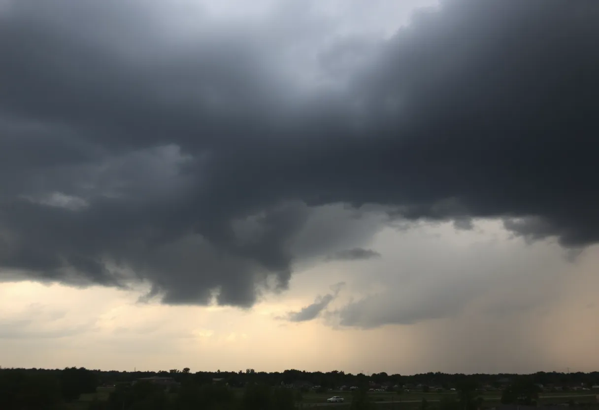
Severe Weather Hits North Texas with Tornado Warnings and Flood Risks
North Texas experienced severe weather on Sunday night, May 18, prompting tornado warnings and flood risks across the region. The National Weather Service issued multiple warnings as the storms moved through, raising concerns for residents in areas like Denton, Parker, and Palo Pinto Counties.
A tornado watch was initially put into effect for several major counties, including Dallas, Tarrant, and Ellis, but was subsequently lifted at 10 p.m. Throughout the night, reports of funnel clouds and tornado-warned storms came in from various locations, particularly from Santo, Texas, where residents Charlize and Chris Trevizo provided video footage. Jeremy and Marisol Lewis also noted funnel cloud sightings in the same area.
Heavy rainfall was a significant feature of the storms, especially in Denton, where showers developed amid the warnings. Lightning caused substantial damage as it struck power lines near Flower Mound. Reports from Grayson County indicated tree damage, along with over 3,000 customers losing power early Sunday morning.
As the storms developed, the National Weather Service confirmed that these severe weather conditions were capable of producing damaging tornadoes, large hail, and strong winds. Specifically, preliminary data suggested quarter to baseball-sized hail fell in Jack, Wise, and Cooke Counties, adding to the severity of the situation.
Earlier in the evening, a tornado was confirmed to have touched down in Parker County, underscoring the threats posed by the storms. Around 10:30 p.m., a severe thunderstorm capable of producing a tornado was also spotted over McKinney.
The Dallas-Fort Worth Metroplex faced another wave of potential severe weather as forecasts indicated a 50% chance of rain and thunderstorms on Monday. The area remained under an enhanced risk of severe storms, particularly in the afternoon. Residents were encouraged to stay alert and prepared for possible tornadoes and damaging winds as additional storms were expected.
In response to the volatile weather conditions, a flash flood warning was issued for Denton County, lasting until 12:30 a.m. on Monday. Reports suggested that numerous funnel clouds were sighted in Palo Pinto County, along with a confirmed tornado over Strawn.
In the wake of the storm, weather forecasts showed a transition to cooler, drier air by the middle of the week. A cold front is projected to arrive late Monday into Tuesday, potentially alleviating some of the severe weather risks currently affecting North Texas.
As the situation develops, Texas residents are urged to stay informed about the weather patterns and be prepared for further severe weather developments into the following days.
Deeper Dive: News & Info About This Topic
HERE Resources
North Texas Faces Severe Weather Threat This Weekend
Severe Weather Hits North Texas with Tornado Warnings
Severe Weather Threats Across North Texas This Weekend
Severe Storms Disrupt Air Travel in Dallas
Severe Thunderstorm System Hits Dallas-Fort Worth Area
Severe Thunderstorm Activity Across North Texas
Dallas-Fort Worth Braces for Severe Weather This Weekend
Saks Global Confirms Overpayment of Tips to Restaurant Employees in North Texas
New Bill Addresses Texas’ Growing Energy Demands
Dallas: A Vibrant Hub for Small Business Growth
Additional Resources
- Dallas News
- Wikipedia: Tornado
- Fox 4 News
- Google Search: North Texas weather severe storms
- CBS News
- Google Scholar: severe weather North Texas
- Star-Telegram
- Encyclopedia Britannica: Severe Weather
- NBC Dallas-Fort Worth
- Google News: severe weather updates North Texas

Author: STAFF HERE DALLAS WRITER
The DALLAS STAFF WRITER represents the experienced team at HEREDallas.com, your go-to source for actionable local news and information in Dallas, Dallas County, and beyond. Specializing in "news you can use," we cover essential topics like product reviews for personal and business needs, local business directories, politics, real estate trends, neighborhood insights, and state news affecting the area—with deep expertise drawn from years of dedicated reporting and strong community input, including local press releases and business updates. We deliver top reporting on high-value events such as the State Fair of Texas, Deep Ellum Arts Festival, and Dallas International Film Festival. Our coverage extends to key organizations like the Dallas Regional Chamber and United Way of Metropolitan Dallas, plus leading businesses in telecommunications, aviation, and semiconductors that power the local economy such as AT&T, Southwest Airlines, and Texas Instruments. As part of the broader HERE network, including HEREAustinTX.com, HERECollegeStation.com, HEREHouston.com, and HERESanAntonio.com, we provide comprehensive, credible insights into Texas's dynamic landscape.