News Summary
A severe thunderstorm impacted the Dallas-Fort Worth area, resulting in over 11,000 customers losing power. The storm brought wind gusts of up to 60 mph and small hail, creating hazardous conditions. The National Weather Service has issued warnings for more storms expected, increasing concerns about potential heavy rainfall and damaging winds. Travelers at DFW Airport faced delays due to these weather conditions, and several highways reported disturbances. Residents are advised to remain vigilant and prepare for additional storm impacts in the coming days.
Severe Thunderstorm Hits DFW Area, Leaving Over 11,000 Customers Without Power
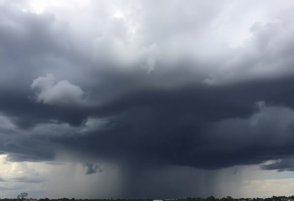
Dallas, TX – A severe thunderstorm swept through the Dallas-Fort Worth (DFW) area on Sunday afternoon, leading to significant disruptions, including over 11,000 customers currently without electricity, according to Oncor. The storm was characterized by strong wind gusts reaching up to 60 mph and small hail, which contributed to both power outages and hazardous driving conditions across the affected regions.
The storm caused a noticeable drop in temperatures, falling more than 10 degrees, with local humidity levels rising. Residents started their day with humid conditions and temperatures in the mid to upper 70s, while cooler temperatures were reported in outlying areas, particularly those near the Red River, dipping into the low 70s and upper 60s.
As of early Sunday, the National Weather Service reported that afternoon high temperatures were expected to rise to the low to mid-90s, with dew points remaining in the low 70s. This high humidity is projected to create a heat index that could feel like it’s in the upper 90s.
Current Weather Developments
As the day progressed, a complex of storms was tracked moving southeast towards the Wichita Falls area but showed signs of weakening. Although the severe thunderstorm warnings initially issued have expired, there remains a 20-30% chance of isolated showers and thunderstorms, particularly west of I-35W and north of I-30.
Looking ahead, another storm system is anticipated to arrive late tonight after midnight, mainly affecting regions west of I-35. The National Weather Service has issued a Level 2 slight risk for severe weather across parts of North Texas, suggesting that initial storm activity may bring gusty winds.
Flight and Road Impacts
The storm has resulted in operational challenges at Dallas Fort Worth International Airport (DFW), where a ground stop has been implemented due to severe weather conditions, leading to flight delays. Travelers are advised to check their flight statuses as these delays continue to affect airport operations.
In terms of ground travel, several major highways including portions of I-35W, I-35E, I-20, I-30, and I-45 have reported disturbances due to adverse weather conditions. Doppler radar showed strong thunderstorms moving southeast at approximately 20 mph, impacting cities like Dallas, Garland, and Grand Prairie between 2:00 PM and 2:15 PM.
Future Forecast and Safety Precautions
The potential for heavy rainfall, damaging winds, and large hail remains a concern for the next thunderstorm complex expected on Monday morning. Residents are encouraged to stay updated on weather alerts and take necessary precautions as new storm activity develops. Meanwhile, high pressure is expected to return following the weekend storms, promising a shift toward hotter and drier conditions, with forecasted triple-digit temperatures early next week.
As North Texas continues to cope with the aftermath of this severe thunderstorm episode, emergency services are on alert, and residents are urged to prepare for any additional storm impacts in the coming days.
Deeper Dive: News & Info About This Topic
HERE Resources
Tragic Fall From Building in Dallas Claims Life
Texas Black Invitational Rodeo Celebrates African American Heritage
Dallas to Host Texas Black Invitational Rodeo
FC Dallas Launches Initiatives for Central Texas Flood Relief
East Dallas Businesses Rally to Support Flood Relief Efforts
Dallas-Fort Worth Thunderstorms and Upcoming Heatwave
Severe Flood Watch Issued for North Texas Amid Storms
Dallas Honors Victims of Flash Flood with Green Ribbons
Flash Flooding in Dallas-Fort Worth Area Results in Rescues
Severe Flooding Hits North Texas Amid Heavy Rainfall
Additional Resources
- Fox 4 News: Dallas Weather August 3
- Wikipedia: Weather in Dallas
- Hindustan Times: Severe Thunderstorm Warning in Dallas
- Google Search: Dallas Weather
- NBC DFW: NBC 5 Weather Forecast
- Encyclopedia Britannica: Weather
- WFAA: DFW Airport Ground Stop and Flight Cancellations
- Google News: Dallas Thunderstorm