News Summary
Dallas-Fort Worth is currently experiencing scattered thunderstorms and showers, with the potential for localized flooding. A Ground Stop has been implemented at DFW Airport. Despite the rain, temperatures are remaining warm, and a transition to a heatwave is expected later in the week, with highs reaching the upper 90s. Community support is rising for flood victims as recent weather events have caused significant damage.
Dallas-Fort Worth Endures Thunderstorms with Heatwave on the Horizon
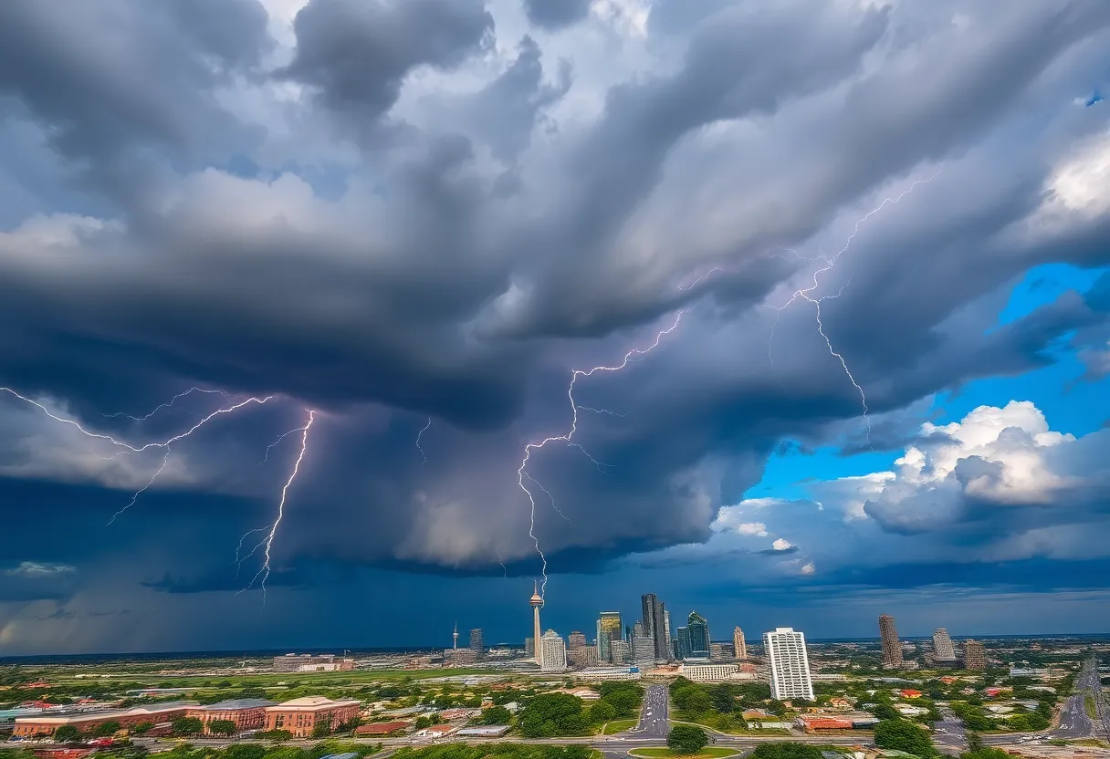
Residents of Dallas-Fort Worth can expect lingering scattered showers and thunderstorms throughout the early part of Tuesday, July 15, as a weather system continues to move through the area. As the day progresses, this disturbance may bring heavy rain and localized flooding in some regions southwest of the Metroplex.
A Ground Stop has been issued at DFW Airport due to ongoing thunderstorms, and travelers are urged to check with their airlines regarding flight status. Meteorologist Evan Andrews has indicated that rain activity will continue throughout the day, with afternoon showers remaining likely.
Despite the rain, temperatures are expected to stay muggy, hovering around 90 degrees Fahrenheit under mostly cloudy skies. The National Weather Service has alerted residents about a heightened risk of flooding that could threaten property and lives particularly in Somervell, Bosque, Johnson, Hill, and Hamilton counties. This risk comes as the storm system affects parts of the Hill Country, with scattered showers and isolated thunderstorms anticipated to develop late tonight into early Tuesday morning.
Transition to Heatwave
As the week progresses, meteorologists are forecasting a shift toward a quieter weather pattern by Wednesday, July 16. The last of the disturbances is projected to move into Oklahoma, allowing high pressure to build from the east. This change in weather is expected to lead to warmer temperatures and brighter, sunnier conditions.
By late week and into the weekend, daytime highs are predicted to rise significantly, moving from the mid-90s to the upper 90s. The “feels like” temperature, which factors in humidity, could reach advisory levels of up to 105 degrees Fahrenheit.
In addition to the thunderstorms, meteorologists are keeping a close eye on a potential Tropical Upper Tropospheric Trough (TUTT) disturbance located along the Gulf Coast later in the week. If this disturbance gains strength, it may impact Southeast Texas by Friday and Saturday, potentially disrupting the developing high-pressure ridge and resulting in scattered afternoon showers, especially in the southeastern regions of the Metroplex.
Recent Weather Impact
The recent weather patterns have already led to flash flooding, causing considerable damages in various parts of the region. In response, public support has surged, raising over $5 million for flood victims as the community bands together to assist those affected by the severe weather.
Tuesday’s Forecast
The forecast for Tuesday indicates warm and humid conditions with a 30% chance of showers and thunderstorms, forecasting a high temperature of 92 degrees Fahrenheit. The predicted temperature range for the following days (from Wednesday to the upcoming Monday) shows a low of 76°F and a high of 97°F, with mostly sunny and humid conditions expected.
Residents are advised to stay informed about weather developments in the coming days, particularly as transition to a heatwave brings new challenges. As always, precautions should be taken in case of severe weather and to ensure safety during the expected heat.
Deeper Dive: News & Info About This Topic
HERE Resources
H-E-B Announces New Store Opening in Aledo
Devastating Floods in Ingram, Texas: Community Unites for Recovery
Texas Businesses Face Rocky Road Amid Trade Tensions
Severe Flood Watch Issued for North Texas Amid Storms
Tragic Loss at Local School: Sisters Drown During Flood
Dallas Honors Victims of Flash Flood with Green Ribbons
Gray Media Donates $25,000 for Texas Flood Relief
President Trump’s Tariff Policy Raises Alarm in Texas
Flash Flooding in Dallas-Fort Worth Area Results in Rescues
Catastrophic Flooding Hits Central Texas
Additional Resources
- Fox 4 News: Flash Flood Warnings
- Wikipedia: Dallas
- Dallas News: Live Radar – Flood Watch
- Google Search: Dallas weather
- AccuWeather: Thunderstorms and Flood Threat
- Encyclopedia Britannica: Dallas
- Statesman: Flight Delays at DFW
- Google News: Dallas Fort Worth weather

Author: STAFF HERE DALLAS WRITER
The DALLAS STAFF WRITER represents the experienced team at HEREDallas.com, your go-to source for actionable local news and information in Dallas, Dallas County, and beyond. Specializing in "news you can use," we cover essential topics like product reviews for personal and business needs, local business directories, politics, real estate trends, neighborhood insights, and state news affecting the area—with deep expertise drawn from years of dedicated reporting and strong community input, including local press releases and business updates. We deliver top reporting on high-value events such as the State Fair of Texas, Deep Ellum Arts Festival, and Dallas International Film Festival. Our coverage extends to key organizations like the Dallas Regional Chamber and United Way of Metropolitan Dallas, plus leading businesses in telecommunications, aviation, and semiconductors that power the local economy such as AT&T, Southwest Airlines, and Texas Instruments. As part of the broader HERE network, including HEREAustinTX.com, HERECollegeStation.com, HEREHouston.com, and HERESanAntonio.com, we provide comprehensive, credible insights into Texas's dynamic landscape.